

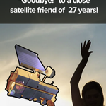




ALT Colorful illustration of a satellite in low-Earth orbit scanning the Florida Keys to collect data


ALT Aerial photograph of a fire-generated cloud. Near the ground, dark brown smoke shows the location of the Widemouth 2 fire in Utah. The smoke rises high into the atmosphere and spreads out. Above the smoke layer are puffy white clouds, including a puff of very tall clouds. Credit: INSPYRE / Bernadett Weinzierl

ALT Photograph of NASA’s ER-2 aircraft on the runway. In the foreground, a person holds two orange lights to signal to the plane. The sunset is orange and pink in the background. Credit: NASA / Milan Loiacono

ALT A photograph shows a truck and two people in yellow firefighting shirts on the side of a road. In the distance is a wildfire and the sky is filled with smoke. Credit: NASA / Milan Loiacono

ALT View of a hilly landscape with trees showing off bright autumnal colors of yellow and orange, with an inset showing a person holding a piece of paper with a scale of colors used for recording fall leaf color data


ALT Map of the Arctic with colors indicating how the sea ice melting season has changed from 2000 to 2009. Red indicates areas where the season grew longer. Blue indicates where it grew shorter. The map is mostly dark red, indicating an increase of about 5 days or more. Closer to the pole, the melting season has changed less dramatically. Credit: NASA

ALT Map of the Arctic with colors indicating how the sea ice melting season has changed from 2010 to 2023. Red indicates areas where the season grew longer. Blue indicates where it grew shorter. The map shows a mix of lighter red and blue, indicating smaller changes of only a few days. Credit: NASA


ALT Hurricane Melissa as seen from the International Space Station on Oct. 28, 2025. Thick white clouds spiral out from the storm's eye 50 miles south of Jamaica. A panel of the ISS cuts in on the left. Credit: NASA

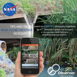
ALT A young person holds a tablet computer up towards a cloudy sky to take a picture

ALT NASA satellite image of fire smoke covering much of Indonesia and Malaysia on September 1, 2026. The plumes are gray, with only some areas of green and brown land visible through the smoke. Red dots have been added to show where the MODIS instrument detected fires. The dots are primarily on the western and southern parts of Indonesia and often cluster together. Credit: NASA

ALT Photograph of adult and juvenile emperor penguins congregating on sea ice in Antarctica. The adults are taller, more slender, and are white and black with distinct yellow collars. The juveniles are shorter, rounder, and have puffier gray fur. Credit: Michael Van Woert, NOAA NESDIS, ORA


ALT View of the city skyline in Addis Ababa, Ethiopia. The air appears slightly hazy and gray clouds fill the sky.

ALT A full disk image of Earth, as seen from the Orion capsule. The image shows Earth at nighttime, using a slow camera shutter speed to bring out details that would otherwise be shrouded in darkness. The planet is a pale blue, swirling with white clouds and glowing slightly lighter blue in places from reflected light. From about 8 to 9 o’clock, a large brown landmass is Africa, with the Iberian peninsula twinkling with lights just where the planet curves. At the 1 o’clock spot, aurora glow in a thin green glow, just barely separated from the planet’s surface. Earth is set against the black of space. Credit: NASA

ALT A map shows the path of totality of the solar eclipse on August 12, 2026, arcing across Greenland, Iceland, the North Atlantic, and Spain.

ALT A global map shows where the August 12, 2026 total solar eclipse will be visible. A red band shows the path of totality. It passes over Greenland, Iceland, northern Russia, Spain, and part of Portugal. Yellow lines indicate percentages of the partial solar eclipse, which will be visible in much of the Northern Hemisphere. Credit: NASA